Services
DATA & SOLUTIONS
Exploiting the latest advances in satellite capabilities, high performance and geo-computing, coupled with our depth of expertise, we deliver practical solutions.

Agricultural information systems
Feeding the world’s growing population, while reducing agriculture’s environmental footprint represents a huge challenge. Climate change is only adding to these pressures.
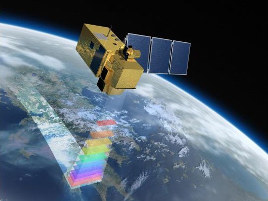
Earth observations can provide near real-time, field-scale information on crops across the globe. Such data offer great opportunities to improve productivity, increase food security and achieve greater sustainability.
Assimila is creating operational systems, based on satellite data, to help manage crop production, forecast yields, and reduce losses from pests and diseases.
With a range of partners, we can provide:
- Crop mapping and analysis
- Crop yield forecasts and historical benchmarking
- Climate change assessment
- Pest risk prediction and management of biopesticide application
We work in the UK, China and Ghana on wheat, maize and coffee, but our techniques are applicable worldwide and to many crops, pests and diseases.
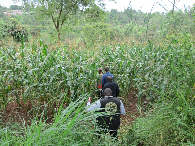
Sustainable crop production
Pest and disease management
Example projects
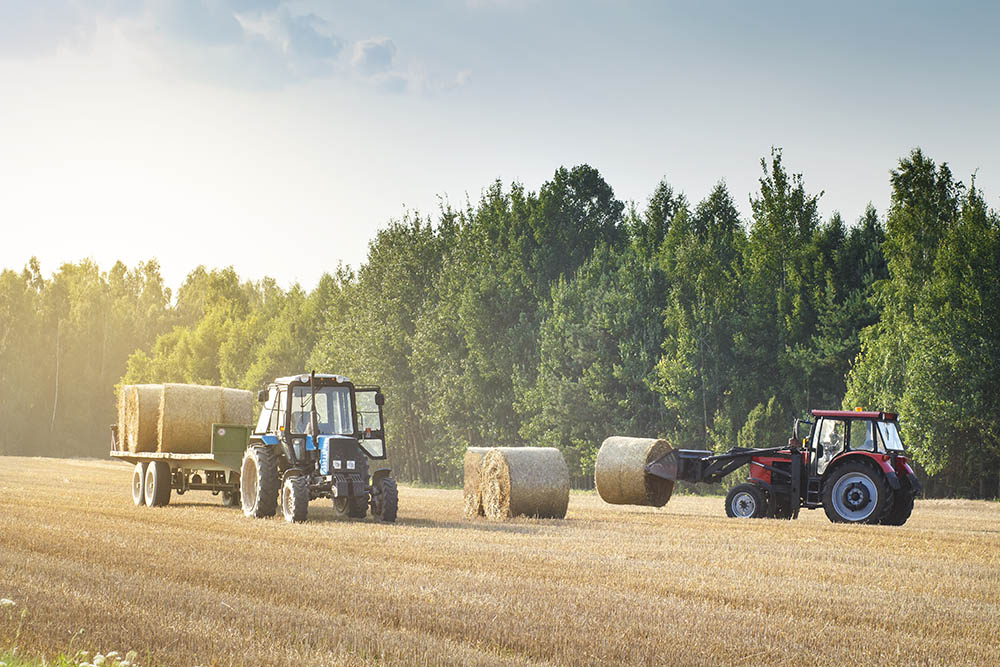
 Sustainable crop production
Assimila is working with partners to develop operational crop forecasting systems using crop modelling, coupled with Earth observations and weather data.
A combination of satellite data from optical sensors and synthetic aperture radar (SAR) can give information down to around 10 m. Such information helps us fine tune crop model output to provide more accurate forecasts at the field scale.
Example projects:
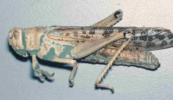
Pest and disease management
Crop pests and diseases are estimated to cause global crop productivity losses of up to 40%. The development of these pests and diseases is strongly linked to environmental conditions, with temperature, rainfall and humidity amongst some of the most important factors.
Traditionally, methods to analyse such environmental factors have used data obtained from a network of in situ meteorological stations, but their sparse geographic coverage limits their use. Earth observation (EO) data overcomes these issues and can provide well-calibrated and spatially continuous data.
Working with CABI, Assimila is combining Earth observations and meteorological data with biological models to assess pest risk and to provide advice on the most suitable timing for the application of biopesticides.
Example projects:
Innovative use of multi-sensor satellite data can provide site-specific field conditions giving near real-time monitoring of crop growth, as well as historical crop information and weather conditions. With climate scenarios we can assess the possible impacts of climate change. We are also coupling Earth observation data with biological models of pest lifecycles.
Accessible data
The atmosphere, land surface and oceans are being observed like never before – with petabytes of data being collected daily. Sophisticated modelling techniques are providing scenarios of future conditions. However, the volume and complexity of such data represent a barrier to realising their full potential.
We can provide the tools needed to access, manipulate and interpret data from the vast array of available satellite sensors and providers. We understand the complexities of Earth observation data – so you don’t need to.
Our tools and accessible data include:
- Assimila Data Cube – a customisable tool to access, pre-process and analyse Earth observation data
- Analysis Ready Data – pre-processed Earth observation data
- ClearSky images – cloud free satellite imagery
We are using the Assimila data cube in pest risk modelling and to understand changes in UK peatlands – just two examples of its potential.
The Assimila Data Cube
Assimila Analysis Ready Data (ARD)
ClearSky imagery
Example projects
The Assimila Data Cube
The Assimila data cube provides easy access to Earth observation data and analysis tools which, in partnership with clients, we can customise for particular applications.
The Assimila Data Cube provides:
- Access -a set of tools that provide access to multiple data portals to either directly download or access data in a cloud environment.
- Pre-processing –to provide analysis-ready datasets with user-specified resolutions, projections and formats.
- Analysis -smart spatio-temporal querying and analysis tools tailored to your needs.
Assimila Analysis Ready Data (ARD)
Deriving value from Earth observation data means being able to extract consistent, meaningful quantitative information from the data. This has to be done efficiently and reliably. While the space industry has made great progress over the past years in data accessibility, users are still faced with obstacles in data discovery, access and pre-processing to ensure consistency.
Combining our in-depth knowledge of EO data and sensors, with our DataCube technology, Assimila offers customers easy access to the right data for their needs, taking away the burden of handling multiple datatypes, formats and pre-processing requirements. We demand high fidelity data for our own high performance modelling applications and so can offer our customers the same calibration, atmospheric correction, mosaicing and compositing capabilities.
For example, Assimila has developed a method for generating coarse resolution optical surface reflectance analysis ready data at 500m using the Moderate Resolution Imaging Spectroradiometer (MODIS) on board the Terra and Aqua platforms and the Ocean and Land Colour Instrument (OLCI) instrument on board Sentinel-3. The Assimila analysis ready data were generated to provide a merged dataset using MODIS and OLCI data that can capture the land surface behaviour and are ready for any user to access via Jupyter Notebooks.
 Assimila ClearSky satellite imagery – land and vegetation
Clouds can obscure the land-surface images we get from satellites, meaning the loss of vital information and making data hard to process.
Assimila have developed sophisticated techniques which combine satellite information to produce composite images free from cloud cover.
Our ClearSky maps provide:
- high-resolution optical and multispectral data
- UK, other parts of Europe and Africa (more areas in development)
- various time periods (more under development)
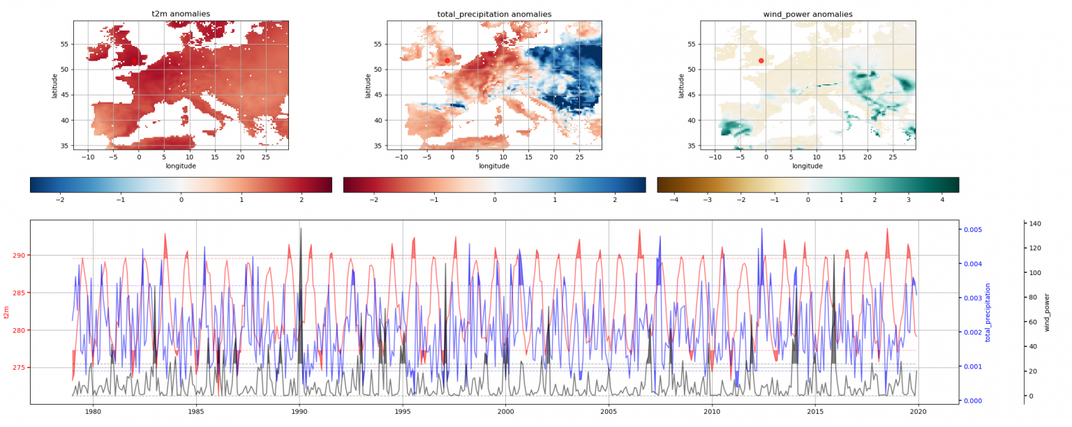
Climate metrics
Climate change means that the future will not be like the past – this brings environmental, social and economic risks. We are already experiencing changes in the severity, frequency and location of extreme events, such as storms and heatwaves.
Assimila is using Earth observation data, coupled with models and ground-based measurements, to provide detailed insight into past and future environmental conditions. Used skilfully, such data can provide information about changing climate risks and tailored decision-support tools.
We are developing:
- Metrics of climate risk
- Methods to assess climate thresholds and changes in weather extremes
- Tools for easy access to climate related data and modelling output
Example projects