The UK Department for Business, Energy & Industrial Strategy (BEIS) commissioned Assimila to assess the feasibility of using Earth Observations data to map Land Cover and Land Use change over the UK to improve emissions inventories.
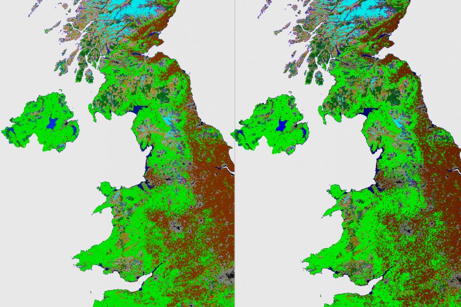
Assimila delivered a methodology that identified land use and land use change over time using optical coarse resolution (>250m pixel resolution) EO data, with an overall accuracy of at least 95% and individual class accuracy of at least 90%. Using a test area covering the UK, MODIS 500m and AVHRR 5km spatial resolution data were used to derive annual land cover / land use (LC/LU) products for 2011 and 2012. Independent reference data was used to validate the product to an overall classification accuracy of 96.57% and 96.58% for 2011 and 2012 respectively was achieved with all individual accuracies better than 94%. Change detection overall accuracy was 95.66%. Hence the methodology using MODIS 500m data is feasible to track LC/LU change over time at this coarse resolution.
A fully costed roadmap for an operational system for tracking land use/land use Change (LULUC) in the UK from 1990 onwards was also provided.